Digital Public Infrastructure (DPI) has emerged as one of the most powerful concepts in modern development. Countries like India, Brazil, and Estonia have shown how digital identity systems, payment rails, and data exchange platforms can transform public services and empower citizens at scale.
But as we celebrate these achievements, we should also acknowledge something important: most DPI systems operate in the digital realm. They excel at managing transactions, verifying identities, and moving data. What they cannot do, by design, is verify what happens in the physical world.
This isn't a criticism—it's simply the nature of digital systems. And it points to an opportunity that we believe deserves more attention.
The Digital-Physical Gap
Consider some of the most impactful programs in global development:
- Government compliance programs that require proof of regulatory adherence
- Public works projects that need verification of construction milestones and quality
- Social programs where aid must reach specific locations and beneficiaries
- Infrastructure monitoring that requires proof of maintenance and inspections
- Insurance claims that depend on verifying conditions and damages on-site
All of these share a common challenge: they need trustworthy information about what happened in a specific place, at a specific time, in the physical world. And this is precisely where digital systems, no matter how sophisticated, face fundamental limitations.
A payment system can confirm that money was transferred. An identity system can verify who you are. But neither can tell you whether a public works project was actually completed, a delivery was made to the right location, or an inspection was genuinely conducted.
Why This Matters More Than Ever
The stakes are significant. Government programs around the world lose billions annually to fraud and misreporting. Development programs struggle with verification of field activities. Insurance claims often cannot be independently verified.
These aren't necessarily problems of bad intent. Often, they stem from the simple fact that reliable field verification is difficult and expensive. Traditional methods—sending auditors, reviewing photos, checking GPS logs—are time-consuming, costly, and often easy to circumvent.
The result is a trust deficit. Organizations want to do the right thing but lack the tools to prove it. Funders want to support impactful programs but struggle to verify outcomes. Citizens want transparency but see no practical way to achieve it.
What Would Good Field Verification Look Like?
Before building Spatial Proof, we spent a lot of time thinking about this question. What would truly trustworthy field verification require?
We identified several key characteristics:
1. Multi-layered verification
A single data point—like a GPS coordinate or a timestamp—can be spoofed relatively easily. Reliable verification needs multiple independent signals that are difficult to fake simultaneously. This might include GPS data cross-referenced with sensor readings, device integrity checks, network information, and environmental data.
2. Works where it's needed most
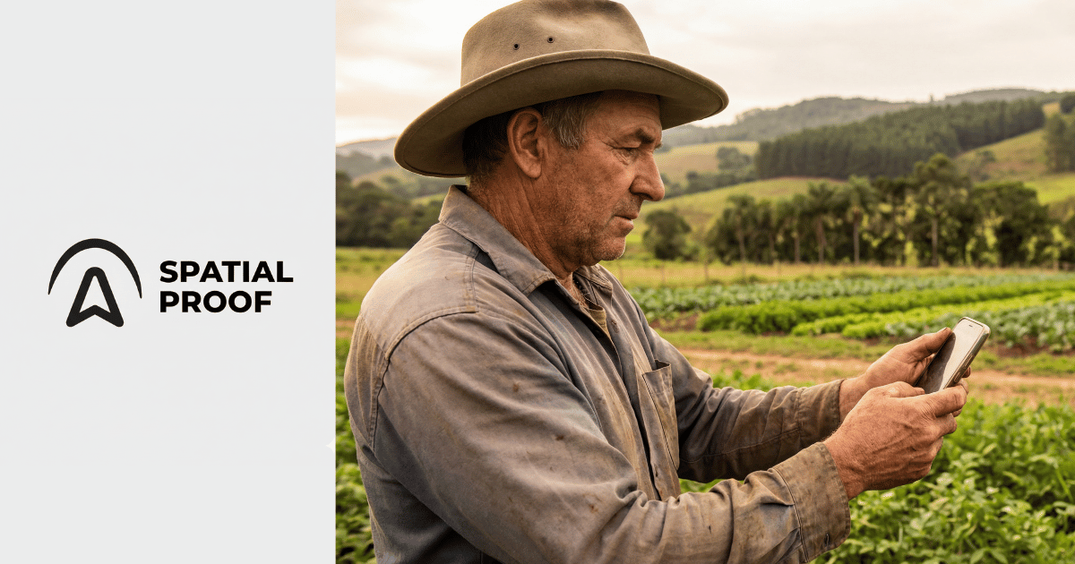
Many of the areas where field verification matters most—remote government project sites, infrastructure locations, rural communities—have limited or no connectivity. Any solution needs to work offline without compromising security.
3. Accessible to everyone
Specialized equipment creates barriers. The ideal solution would work on devices people already have—smartphones—without requiring expensive hardware or extensive training.
4. Verifiable by anyone
Trust shouldn't depend on taking someone's word for it. Verification data should be independently auditable by any interested party.
5. Respectful of privacy
Verification doesn't require surveillance. It's possible to prove that an activity occurred without continuously tracking individuals.
Our Approach with Spatial Proof
We built Spatial Proof as our attempt to address this challenge. We don't claim to have all the answers, but we've tried to create something that embodies the principles above.
At its core, Spatial Proof captures multiple verification signals at the moment of field activity—GPS coordinates, sensor data, device integrity information, timestamps, and environmental factors. These are combined and cryptographically secured to create a verification record that can be independently audited.
The system works entirely offline, encrypting data locally until connectivity is available. It runs on standard smartphones, requiring no specialized equipment. And it's designed as infrastructure—an API that organizations can integrate into their existing systems.
We've been testing this approach with government compliance programs and field verification initiatives across multiple sectors. The early results are encouraging, though we're still learning and improving.
Complementing, Not Replacing, Existing DPI
We see field verification as complementary to existing DPI systems, not competitive with them.
Digital identity systems like Aadhaar or Gov.br can verify who is performing an activity. Payment rails can track what was transacted. Data exchange platforms can share information across organizations.
Field verification adds the where and when—and provides evidence that an activity actually occurred in the physical world.
Imagine combining these capabilities:
- A government program where inspector identity is verified through national ID systems, payments flow through digital rails, and field activities are verified through spatial-temporal proof
- A social program where beneficiary identity is confirmed, disbursements are tracked digitally, and aid delivery is verified at the point of service
- A government infrastructure project where contractors are authenticated, payments are recorded, and work completion is independently verified
This is the potential of complete verification: digital and physical, identity and action, transaction and outcome.
The Road Ahead
We're early in this journey, and there's much more work to do.
Technical challenges remain—improving accuracy, reducing false positives, handling edge cases. Adoption challenges are real—integrating with existing systems, training field workers, building trust with stakeholders. And there are important questions about governance, standards, and interoperability that the broader community needs to address.
We don't pretend to have all the answers. But we believe the question is important enough that it deserves serious attention from the DPI community.
If we can solve field verification—if we can reliably bridge the gap between digital systems and physical reality—we unlock new possibilities for accountability, transparency, and trust. Government agencies can prove compliance. Social programs can demonstrate their reach. Citizens can verify that their governments are delivering on promises.
"The most sophisticated digital system in the world cannot tell you whether an inspection was conducted or a public work was completed. That's not a flaw—it's just the nature of digital systems. The opportunity is in bridging this gap."
"Digital Public Infrastructure without a verification layer is like a banking system without transaction records. You can move the money, but you cannot prove where it went or why."
Joining the Conversation
We're sharing our thinking not because we have all the answers, but because we believe this conversation is important. Field verification is a missing piece in the DPI ecosystem, and addressing it will require collaboration across governments, organizations, technologists, and communities.
If you're working on similar challenges, we'd love to hear from you. If you see flaws in our approach, we want to learn. And if you're interested in exploring how field verification might fit into your work, we're happy to share what we've learned.
The problems we're trying to solve—government fraud, development effectiveness, public accountability—are too important for any single organization to address alone. We're just trying to contribute one piece to the puzzle.